The Real Africa
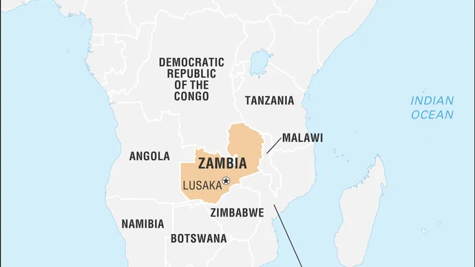
Zambia, landlocked country in south-central Africa. It is situated on a high plateau and takes its name from the Zambezi River, which drains all but a small northern part of the country.
Large parts of Zambia are thinly populated. Much of population is concentrated in the country’s most developed area—known as the Line of Rail—which is served by the railway linking the Copperbelt with Lusaka, the capital, and with the border town of Livingstone.
Land
Zambia has a long land border on the west with Angola but is divided from its neighbours to the south by the Zambezi River. To the southwest is the thin projection of Namibian territory known as the Caprivi Strip, at the eastern end of which Zambia and three of its neighbours (Namibia, Botswana, and Zimbabwe) appear to meet at a point—a “quadripoint”—although the precise nature of the meeting is contested. Man-made Lake Kariba now forms part of the river border with Zimbabwe. Zambia’s other neighbours include Mozambique to the southeast, Malawi to the east, and Tanzania to the northeast. The long border with the Democratic Republic of the Congo starts at Lake Tanganyika, crosses to Lake Mweru, and follows the Luapula River to the Pedicle, a wedge of Congolese territory that cuts deep into Zambia to give the country its distinctive butterfly shape. Westward from the Pedicle the frontier follows the Zambezi-Congo watershed to the Angolan border.
Drainage
The continental divide—between the Congo River drainage, which flows to the Atlantic Ocean, and that of the Zambezi, which drains into the Indian Ocean—runs along the border shared by Zambia and the Democratic Republic of the Congo west of the Pedicle and then northeastward to the border with Tanzania. Both the Luapula (which drains the Bangweulu basin into Lake Mweru) and Lake Tanganyika are tributary to the Congo.
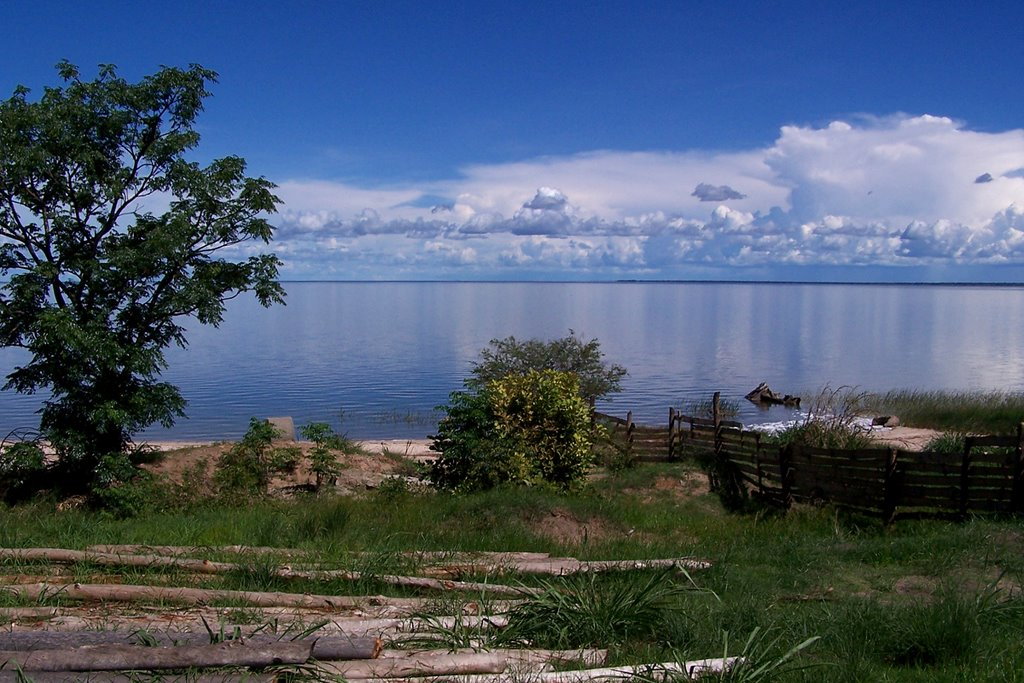
LAKE BANGWEULU
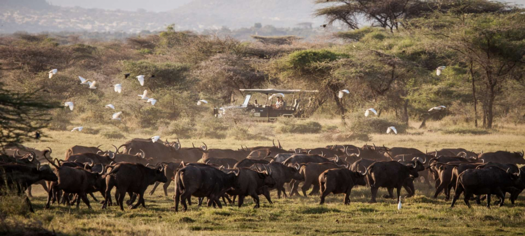
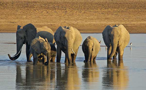
The rest of the country lies within the Zambezi basin, the river itself rising in northwestern Zambia and circling through Angola before traversing the sandy plains of western Zambia. At Victoria Falls it drops some 300 feet (90 metres) into a milewide chasm at the head of the gorge leading down to Lake Kariba and the troughlike middle part of its valley. It has two main tributaries in Zambia. Rising on the Copperbelt, the Kafue River drains the Lukanga Swamp and Kafue Flats before an abrupt descent to the Zambezi. The Luangwa River, mostly confined within its rift trough, is quite different. The Bangweulu Swamps and the Kafue Flats are wetlands of international ecological importance.
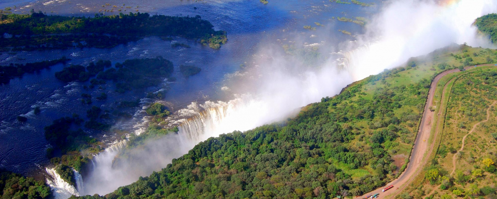
THE MIGHTY VICTORIA FALLS
Plant and Animal Life
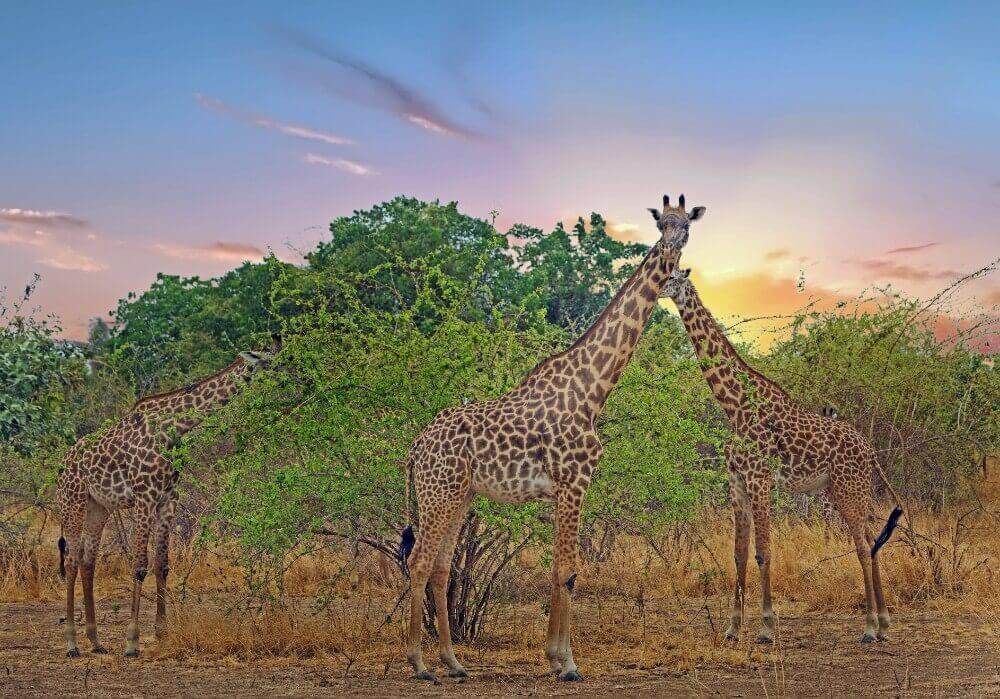
On the plateau, miombo woodland is characteristic: a semicontinuous tree cover dominated by small leguminous trees of the Brachystegia and Julbernardia genera but with a significant grassy undergrowth. Burning of the grasses in the dry season causes the trees to develop a corky, fire-resistant bark. Mopane woodland, in which Colophospermum mopane dominates but in which the baobab is distinctive, occurs in the drier and hotter valleys of the Zambezi in the south and in the Luangwa valley. Zambezi teak (Baikiea plurijuga) occurs in the southern fringe of the area covered by the Kalahari Sands. Mukwa (Pterocarpus angolensis), a good furniture timber, is found in the Lake Bangweulu area. More than one-tenth of the country has been set aside as forest reserve or protected forest areas; in all, some two-fifths of the country’s land is under protection.